
What Are Postcodes?
All the countries around the globe use postal codes. It is one of the few things we have in common regardless of where we are from or where we live. Almost all countries have the same or similar postal code system. But, they are known by several names.
Initially, postal codes in the UK went by their original name, but now the postal codes in the UK are called postcodes. Furthermore, postal codes in the British Overseas Territories and Crown dependencies are also called postcodes. At the same time, you will find a different name for postal codes in other countries.
For example, the postal codes in the United States are called ZIP codes. Similarly, in India, they call their postal codes by the name PIN codes. So, it might be confusing to people or, more likely, businesses that send out domestic and international direct mails.
Postcodes play a vital role in facilitating easy and efficient direct mail communication. Despite the boom of the digital age, postal mail remains a formidable communication medium, especially for businesses. With the advent of direct mail automation, more and more businesses are turning to direct mail marketing.
But, most of them do not understand postcodes or their significance in direct mail campaigns. Here, we will discuss what postal codes are, how they can help your business operation, and more. A proper understanding of the postal codes will help you to organize effective direct mail campaigns.
Furthermore, it will also help you streamline your direct mail operations, including targeting customers. So, if you are planning on implementing direct mail marketing for your business, you should keep on reading.
What is the UK Postal Code or Postcode?
The UK postal code is also known as postcode. It is the postal code used for addresses inside the United Kingdom. They are similar to ZIP codes used in the US as they both serve the same purpose. Both postal codes are used to denote addresses in their respective countries.
However, how UK postal code is denoted is very different from ZIP codes in the US. The postal codes in the UK are alphanumeric whereas, and the ZIP codes contain only numbers. This difference is because the system used to determine and categorize the addresses in both countries are different.
Early History
Although the postal code as we know it was only established around the late fifties, the idea was conceived much earlier. You could even say that the idea for a postal code system originated in England or London, to be more precise.
In 1857, almost a hundred years before the inception of the modern-day postal code, London was divided into ten postal districts. It became increasingly challenging to manage postal mail delivery in a hectic city such as London.
Modern Postcode System
The postal code in the UK was devised by the General Post Office, which is today’s Royal Mail. Alphanumeric postal codes were first implemented in the UK in 1959, but they continued evolving for years. It was around this time Royal Mail tried to use electromechanical sorting machines on an experimental basis.
Soon, Royal Mail came up with a six-character alphanumeric code. This new postcode assigned three letters to a geographical area and three numbers to identify individual addresses. By 1974 the UK postal codes were pretty much optimized, and only slight modifications have been made to it since then.

Why is Understanding Postcodes Important?
We know that the postal codes were first developed by the Royal Mail for enhancing and streamlining postal deliveries. But, you must understand that postcodes and their geography have become an integral part of business planning over the years.
It is true for the UK postal codes and all the postal codes around the world, including ZIP codes in the US. The application of postal codes is not just limited to postal delivery and has excellent growth potential. Hence, businesses must get a proper understanding of postal codes.
Formulate Marketing Strategies
Understanding postal codes and their working is essential for advanced marketing strategies like automated direct mail marketing. For example, systems like PostGrid automate your direct mail campaigns and provide you with advanced features.
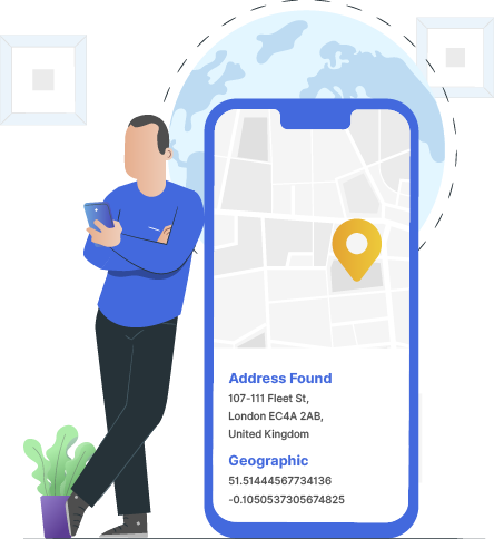
PostGrid also enables you to have advanced capabilities like geocoding and reverse geocoding. Using such a feature, you can easily plot the presence of your target audience in specific areas. You can then use this map or data to develop targeted campaigns explicitly made for these locations.
Explaining How Postcodes Work
As we have briefly mentioned before, the postcodes are a combination of numbers and letters or, in other words, alphanumeric. Usually, a postcode consists of five or seven characters, and they are used to identify a group of addresses/houses.
The UK postal codes have two parts: an outward and an inward code, and space separates them. It is also worth noting that every full postcode contains fifteen delivery points on average. Moreover, each postal delivery by the Royal Mail also happens in two stages.
Routing of Mailer Using Postcodes
Every time a letter is collected for delivery, it is identified using the first part of the UK postal code or the outward code. After identifying the outward code, the mailer gets routed to its main sorting office. Similarly, the local sorting office identifies the second part of the postcode or the Inward Code.
The mailers get assigned to individual mail carriers by the local sorting offices. A similar system is used for postal delivery all around the world. However, when it comes to UK postal codes or postcodes, they operate at four levels.
The four levels of operation of a UK postal code are better explained through an example. So, from here on, let’s consider the postcode SP7 0AG to explain how postcodes work.
Level 1: Area Postcodes
The Royal Mail has divided the areas it serves into 124 parts for making quick and easy postal deliveries. As you can see in the postcode example, we have taken that the postcode is split into two halves. Note that the postcode’s first part is the outward half of the postcode.
The first two letters of the postcode are used to represent the area postcode. If we consider the postcode example SP7 0AG, the area postcode would be SP. Usually, the area postcodes are named based on the area or Post Town they cover. However, It is not always the case.
The SP in the example we have taken denotes the Post Town Salisbury. Similarly, AB is used to represent the Post Town Aberdeen, YO for the Post Town York, and so on. Pretty simple, isn’t it? So this way, the Royal Mail can easily identify which Post Town your mail should go to.
Special Cases
Some area postcodes are unlike the normal ones we are familiar with and look disconnected from the Post Town they represent. Take Rochester in Kent or Lerwick in Shetland, for example. Their area codes are ME and ZE, respectively.
Both of these area codes may seemingly appear disconnected from their respective Post Towns. However, that is not always the case. Here, ZE for Shetland was derived from the Zetland, an archaic spelling of Shetland.
Similarly, London also has area codes that do not really align with Post Town. It is because they had developed a postal system for London way back in the 19th century. For example, the area code for North London is simply “N.”
Trivia
Did you know that the smallest size area code in the UK is WC, West Central London? Its area is only 2.59 square kilometres. In the meantime, Inverness (IV) is the area code with the biggest size. Inverness spread to an area of 16169.3 square kilometres.
It is worth noting that the average size of an area postcode is 2009.831 square kilometres. Shetland (ZE) has the least number of districts, with only three of them in it. At the same time, Belfast, with 80 districts, has the largest number of districts.
Level 2: District Postcodes
As you might have already guessed, each postcode area is further divided into district postcodes for segmentation purposes. The district postcode is denoted by the number or numbers immediately following the area postcode.
Let’s consider the postcode example SP7 0AG again. Here, the district code is the 7 in SP7. Similarly, you can find the district postcode in every postcode. The district postcode may contain one or more than one digit, so the space between the outward and inward is essential.
Provision of Districts in Postcode Areas
There are almost 3000 postal districts all over the UK. By subdividing the area postcodes, the district postcodes enable the Royal Mail to route the mail to their relevant sorting offices. We know that districts fall into different areas, and there are around 23 districts in an area.
However, the actual number of districts in an area can vary anywhere between 3 and 77. This variation is mainly due to the considerable difference in size and population of the postal regions.
Trivia
The smallest postcode district in the UK is Eastern Central London or EC2N, with a 0.07 square kilometres area. On the other hand, the biggest postcode district is Lairg, and the district code is IV27. It has a massive area of 3607.8 square kilometres. Thus, the average size of a postcode district in the UK is 85.47 square kilometres.
Level 3: Sector Postcodes
Each postcode district in the UK is further divided into various sectors. Similar to the district code, the sector code is also denoted using numbers. In the postcodes, they are written right after the district code however, they are separated by space.
It also means that the sector code is a part of the inward code that we have mentioned above. Whereas, the district code is a part of the outward code or the first half of the postcode. As both are numeric, separating the district from sector codes avoids unnecessary confusion.
Forgetting to add the space between the inward and outward codes is one of the common mistakes businesses make. Although such minor mistakes are expected now and then, it is not ideal for business communications.
It is why most businesses now choose to use an automated direct mail system like PostGrid. With a tool like PostGrid, every address is standardized and verified, so there is no scope for such errors.
Provision of Sectors in Postcode Districts
There are around 11,200 postal sectors in the UK. The postal sectors play a vital role in helping the Royal Mail to pick their delivery rounds. There can be 1 to 10 sectors in a postal district. However, the average number of postal sectors in a district is three.
Trivia
The smallest postal sector in the United Kingdom is in London, which is EC3A 1. It has an area of merely 0.002 square kilometres. On the other hand, Sutherland in Lairg is the largest postal sector, and it has an area of 3607.8 square kilometres. This brings the average postal sector area size to 25.1 square kilometres.
Level 4: Unit Postcodes
Unit postcode is the fourth and final level of a UK postal code. It is used to point you towards a group of houses or addresses. The unit postal code can be used to describe a particular property or a set of properties. Listed below are the type of properties that can be described using a unit postcode:
- Street or a part of the street
- Single Addresses
- Group of Properties
- A subsection of a property
- Individual organizations
- Departments within an organization
As you can guess, there is a vast number of unit postcodes in the UK, over 1.7 million to be exact. However, this number regularly keeps on changing as around 2750 unit postcodes are created, and 2500 unit postcodes are terminated every month.
Large User Postcode For Organizations
It is worth noting that the Royal mail allocates some organizations with a unique postcode. These unique postcodes are assigned to better segment the delivery of a large number of mails made to a single address.
However, to qualify for a unique postal code, an organization must receive an average of 50 mailers or more a day. Therefore, the Royal Mail allocates your organization a large user postcode only if this condition is met. For example, DVLA is a prominent mail user, and they have different postcodes for their various departments.
Importance of Unit Postcodes
You may think of unit postcodes as worker ants that do all the work on a base level. Unit postcodes enable you to identify around thirty million addresses or delivery points in the UK. So, you can deliver to a particular address only because you have the address’s unit postcode.
As you can guess, you need at least one delivery point to constitute a unit postcode. Furthermore, a unit postcode can have as many as 100 delivery points. However, the average number of delivery points in a unit postcode is 17.
Trivia
Each postal sector has 180 postcodes on average. As mentioned above, a postal sector needs to have at least one postcode address and a maximum of 390. However, theoretically, the maximum number of postcodes in a postal area is 400.
What is a Postal Code Used For Other Than Sending Mailers?
Although the primary application of the UK postal code is to send mailers throughout the UK, that is not all postcodes do.
Since postcodes find their way into sectors, districts, and areas, they can define geographical locations. Its capability to define locations through the UK showed immense potential for business marketing. Listed below are some of the significant applications of postcodes.
Demographic Profiling
The population inhabiting the whole of the UK is 67 million people. Each of these 67 million people has its personality. They may have a different outlook on life, different priorities, needs, and they all lead to a way of life that is unique to them.
With such a diverse and rich tapestry of life, the United Kingdom is home to audiences of all kinds. Therefore, it presents an immense opportunity for marketers in practically all industry verticals. However, it is seemingly impossible to identify the ideal audience for your product or service.
Identifying Distinct Groups
Demographic profiling is all about identifying distinct groups of people from a vast population such as the UK. The unique group of people you choose to target should have a lifestyle and needs that perfectly fit the product/service you are offering.
Some businesses may already have an existing database of such potential customers. But that is not always the case. Moreover, even the ones with an existing database may want to expand their target audience. So, in either of these cases, you would need a solution like geodemographic classification.
Postcode Mapping And Geographic Analysis
Businesses or more particularly marketers can get a better understanding of their target audience through postcode mapping. It enables you to get geographical context to your data, including customer behaviour. Provided below are some of the ways you can access and utilize postcode data.
Postcode Point Mapping
A point set map can be based on several things such as full UK postal codes, geocodes, or a general central point. For example, the central point referred to could be based on incomplete postcodes, postcode sectors or areas, or even administrative geography.
Postcode point mapping enables you to chart features of interest in a geographic region. Furthermore, the mapping makes it easier to understand as the data is converted from a table format. The points you can map can be anything such as your best customers, store and sales network, and so on.
Heat Mapping
Even complex data can be made easily understandable with the help of a heat map. Therefore, it is no wonder that numerous businesses use heat mapping for plotting crucial aspects of their business data. Some of the popular data used for heat mapping include the following:
- Customer/Competitor locations
- The average value in an area (e.g., purchase levels)
- Demographic trends
- Distance between customer’s residence and stores/reps
You can even set the areas of our maps using postcode, administrative areas, and more. Furthermore, a heat map can use colour coding to better understand the map and its data. It means you can use red, amber, green, or any other colour scale. You can even choose a colour scheme that matches your company’s branding.
Postcode Territory Mapping
Territories or catchments are created via postcodes, and they can be used for guiding sales and delivery networks. Usually, these maps can be based on several things, such as a list of postcode references or fixed radii from specific points.
Additionally, you can also base the maps on customer value within an area or number of households that fit a demographic group. You can even overlap or draw borders to calculate catchments depending on the tool you are using.
Postcode Sector or Area Mapping
Sometimes businesses may require maps, not of a specific area, but of a specific area. For example, consider a marketing campaign that’s targeted within a certain geographic area. In such cases, postcodes play a vital role in formulating a map for your business.
What is ZIP Postal Code?
The ZIP in ZIP code is short for the Zonal Improvement Plan. As we have mentioned before, the postal code system is universal, and it goes by different names in different parts of the world. The ZIP codes are the postal code system that is used in the US.
Like the postcodes in the UK, the ZIP codes also enable their postal service provider to identify locations or addresses. However, the US ZIP code system uses a 9-digit ZIP code system, unlike the alphanumeric system used in the UK.
Postcode Vs ZIP Code
| Basis For Comparison | Postcode | ZIP Code |
| Country | The United Kingdom | The United States of America |
| Year of Inception | 1959 | 1963 |
| Purpose of Creation | Address reference, identification of locations, census and route planning | Address reference and identification of locations |
| Numeric/Alphanumeric | Alphanumeric | Numeric |
| Length | The length of the postcode can vary depending on unique locations. | Between 5-9 characters. A full ZIP code consists of 9 digits. You may choose to use the first five digits but, it can affect the accuracy of the address. |
Automated Solution For Determining Postcodes
The primary purpose of the UK postal code for businesses is to send direct mail to their customers or clients. However, getting access to accurate postcodes is not so easy. Even accurately copying the postcode to a mailer can be hard at times, especially if your business sends bulk direct mails.
Thankfully there are advanced solutions like PostGrid that can help you verify and standardize address databases. For example, PostGrid’s address verification API allows you to bulk verify your addresses using a simple CSV file.
Also, you can choose to print your direct mails, including postcards, brochures, newsletters, and more via PostGrid. By doing so, you can be sure that your mailers have validated and standardized addresses. PostGrid even offers advanced capabilities like geocoding to make the most out of your marketing efforts.
Conclusion
Postal code is used for numerous purposes today, and its scope goes well beyond postal mail delivery. For example, businesses now rely on postcodes not just for delivering marketing and communication mailers but also for advanced marketing strategies.
Postal code plays a vital role in advanced operations, including demographic profiling and postcode mapping. However, all of this requires accurate postcode data. Powerful address verification API such as PostGrid can help you access accurate postcode data via Royal Mail’s address database.
PostGrid also has advanced capabilities like geocoding, which can help you in postcode mapping. Therefore, tools like PostGrid enable you to target your direct mail better and enhance its results. You can even personalize, print, and mail your direct mail via the Royal Mail using PostGrid.
It is high time businesses adopt innovative solutions like PostGrid to streamline their direct mail operations. With an exceedingly high deliverability rate and automated process, you can minimize your postcodes and direct mail errors. As a result, you will be able to run seamless direct mail campaigns and access deep insights that you never could before.

The post What Are Postcodes? appeared first on PostGrid UK.
Via https://www.postgrid.co.uk/what-is-postcode/
source https://postgridunitedkingdom.weebly.com/blog/what-are-postcodes


No comments:
Post a Comment